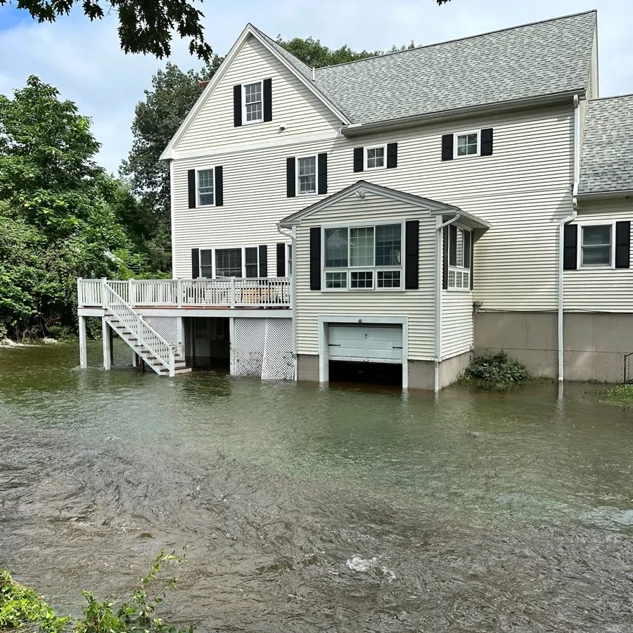
Bow's flood risk runs along the Merrimack River, which forms the town's northeastern border. A 2006 hazard plan counted 174 homes and 43 non-residential buildings in or next to the floodplain, mostly in the eastern and northeastern parts of town.
Key takeaways
- The Merrimack River forms the northeastern border, and floodplain homes sit mostly in the eastern and northeastern parts of town.
- Hall Street and River Road are named in the hazard plans as places that can flood in severe storms.
- In the May 2006 flood, private property damage was mostly in flooded basements.
- River flood water is treated as contaminated, so cleanup includes removal and cleaning, not just drying.
- Extraction, mud removal and measured drying should start quickly, since mold can begin in 24 to 48 hours.
Where the floodplain sits
Route 3A, River Road and Hall Street run along the river side of town, with a railroad following the Merrimack beside them. The hazard plans name Hall Street, River Road, Dunklee Road, the Bow Bog Meeting House and other low-lying areas as places that can flood in severe storms.
The ground adds context. The town sits on glacial till over bedrock, with sand and gravel deposits throughout and glacial clays and stratified sand and silt beside the river.
- 174 homes and 43 non-residential buildings in or next to the floodplain in the 2006 count
- Most of them in the eastern and northeastern parts of town
- Hall Street and River Road named as flood-prone
- Dunklee Road also named in the hazard plans
Other waterways in town
The Merrimack is not the only water to watch. The Turkey River runs through Bow Mills, and the South Street bridge over it came very close to overtopping in the 2006 flood.
Bow Bog Brook and Black Brook are named streams, and Turee Pond is a named pond. Heavy rain can raise small waterways quickly even when the big river is steady.
Reading the hazard plans
A hazard plan is a town document that records where flooding has happened or could happen. Homeowners can use it as a starting point for understanding their own exposure.
The plans here name specific roads and low-lying areas, which makes them more useful than a general warning about the river.
- Look for the home's road among the named flood-prone roads.
- Note whether the road closed in past floods, since access matters for cleanup.
- Ask the building and permit offices for current flood map information.
What May 2006 did to basements
The Mother's Day flood of May 2006 caused more than $1 million in damage to public property. Damage to private property was mostly in flooded basements of residences.
Culverts washed out on Dunklee Road and Page Road and both roads closed, and Dunklee Road stayed closed for more than three months. A flood here can cut off access as well as fill a basement.
For a homeowner the lesson is practical. In 2006 the common loss was the basement, so the belongings and mechanical equipment kept there were the most exposed.
Riverbank erosion on Hall Street and River Road
The hazard plans say Merrimack River erosion has threatened riverbank homes on Hall Street and River Road itself. Sediment from the Suncook River adds to the bank erosion.
Erosion does not flood a basement by itself, but a weakened bank and high water together raise the stakes for the homes along the river.
The practical point for a basement is the soil. Glacial clays and stratified sand and silt beside the river hold and move water differently from the sand and gravel found elsewhere in town, so a wet spot can linger after the river drops.
River water is contaminated water
Flood water from a river is classified as Category 3, because it carries silt, bacteria and whatever the river picked up on the way. It is handled differently from a clean supply leak.
A flood water cleanup treats it that way: contaminated materials are removed and discarded, not dried in place.
- Carpet, pad and insulation that touched the water are removed.
- Drywall that wicked river water is cut out.
- Mud and silt are shoveled and rinsed out.
- Hard surfaces are cleaned and disinfected.
- Stored cardboard and other porous items are discarded.
Time matters after a flood
Flood water that sits in a basement keeps soaking into wood, drywall and stored goods. Mold can begin in 24 to 48 hours, and river silt holds moisture against surfaces long after the water is gone.
- Water out first.
- Silt out next.
- Drying before any wall is closed.
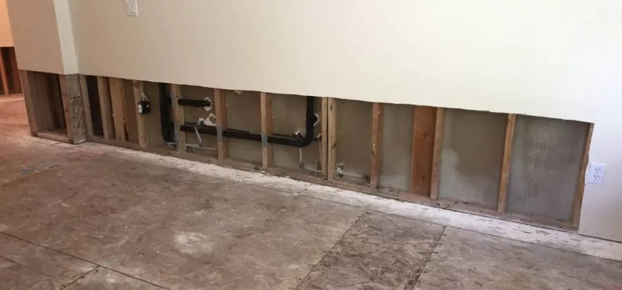
Steps in a flooded basement
Cleanup has an order, and skipping ahead costs time later. A basement flooding cleanup moves through the same steps whether the water is a few inches or a few feet deep.
- Make the area electrically safe before anyone enters.
- Extract standing water with pumps and wet vacuums.
- Remove mud and silt from floors and wall bases.
- Cut out and bag contaminated materials.
- Clean and disinfect the structure.
- Dry with air movers and dehumidifiers, guided by moisture readings.
What to record before cleanup
Records taken early are easier to trust later. Photos of the water mark on the wall, the damaged items and the equipment in the basement show what the flood reached.
- Photograph the highest mark water left on walls and stairs.
- List damaged belongings with a short note on each.
- Keep receipts for any emergency supplies.
- Note the date and time the water first appeared.
Preparing for high water
Whether or not a home sits in the floodplain, a few habits help when river levels rise. The Bow water damage experts handle river flooding with the same Category 3 steps used for flood water cleanup across the area.
- Keep valuables and electronics off the basement floor.
- Know where the main electrical shutoff is and how to reach it safely.
- Move vehicles and outdoor items before water arrives.
- Photograph the basement while it is dry, for comparison later.
- Keep the contact details of a restoration crew in an easy place.
Questions
Which parts of Bow are most exposed to Merrimack River flooding?
In the 2006 hazard plan count, floodplain homes were mostly in the eastern and northeastern parts of town beside the river. Hall Street and River Road are named among the places that can flood in severe storms.
How were private homes affected in the May 2006 flood?
Damage to private property was mostly in flooded basements of residences.
Is river flood water safe to clean up without protective gear?
No. River water is Category 3 and can carry bacteria, so protective gear and proper disposal of soaked materials matter.
Why did Dunklee Road stay closed so long?
Culverts on Dunklee Road washed out in the May 2006 flood, and the road stayed closed for more than three months.
How fast should drying begin after a basement floods?
As soon as the water is out and the area is safe, because mold can begin to grow within 24 to 48 hours.
What is the first step if river water has reached the basement?
Stay out until the electricity is safe, then photograph the damage and call a crew. Standing river water is extracted first, and everything that touched it is then cleaned or removed.